Email: james@mapmogul.com
Web site: https://www.mapmogul.com/
|
|
Tel: +44 (0) 7764 165300 - Order by Phone / Online Email: james@mapmogul.com Web site: https://www.mapmogul.com/ |
|
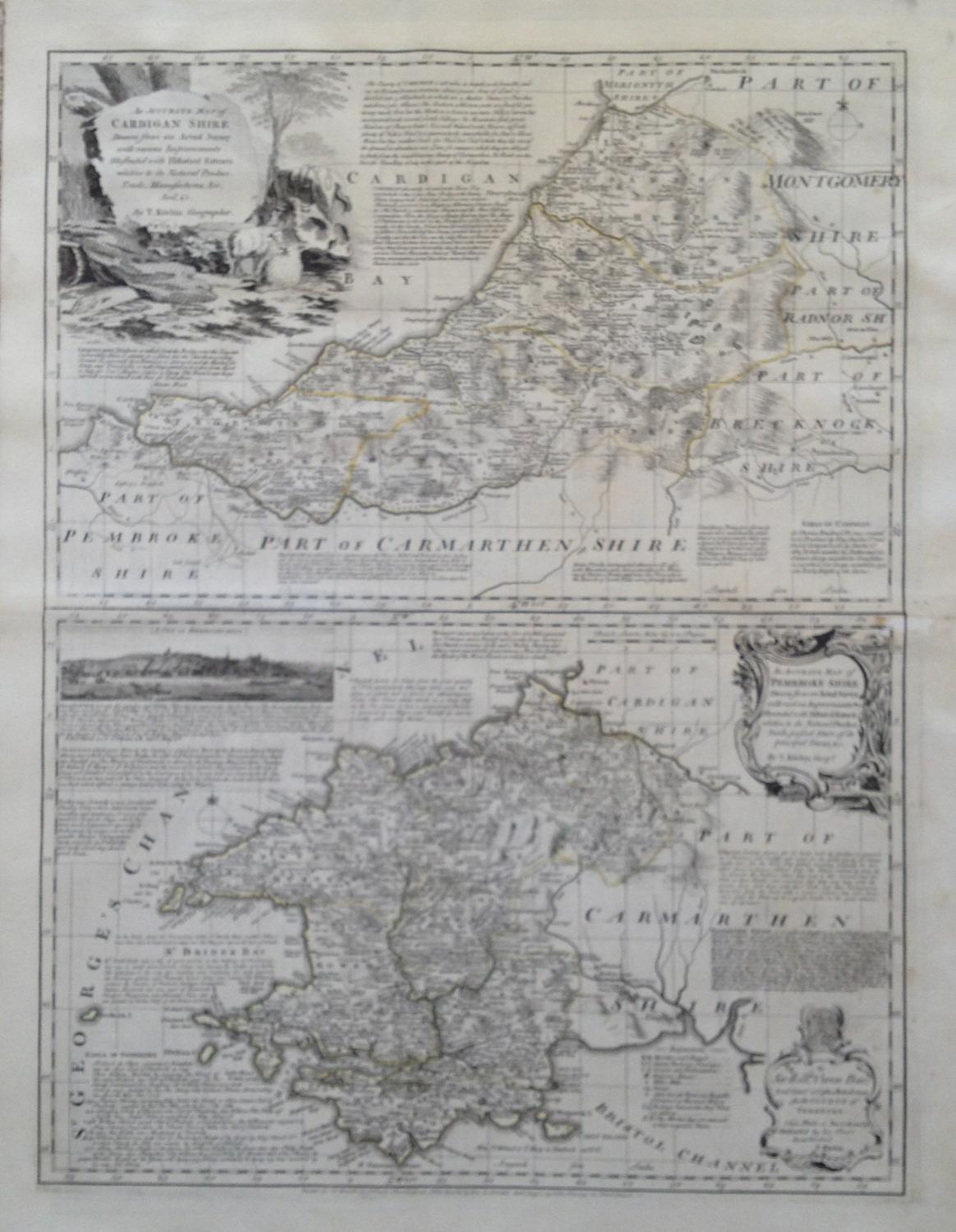
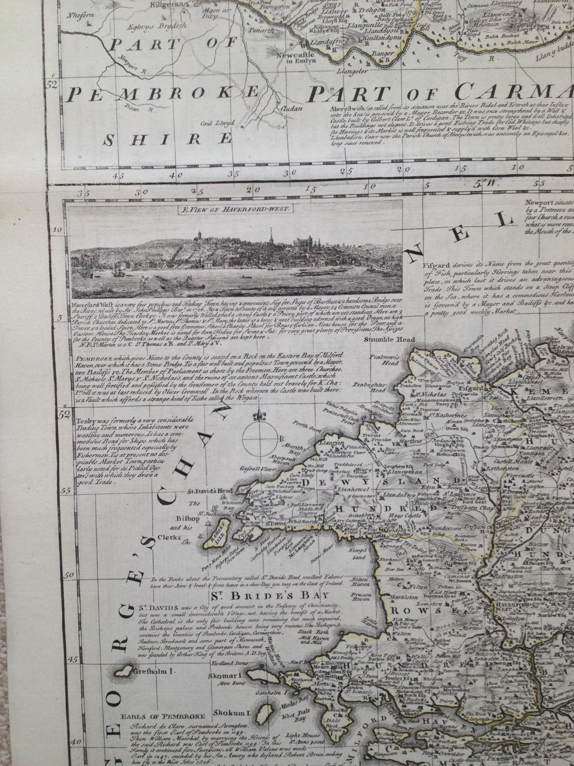
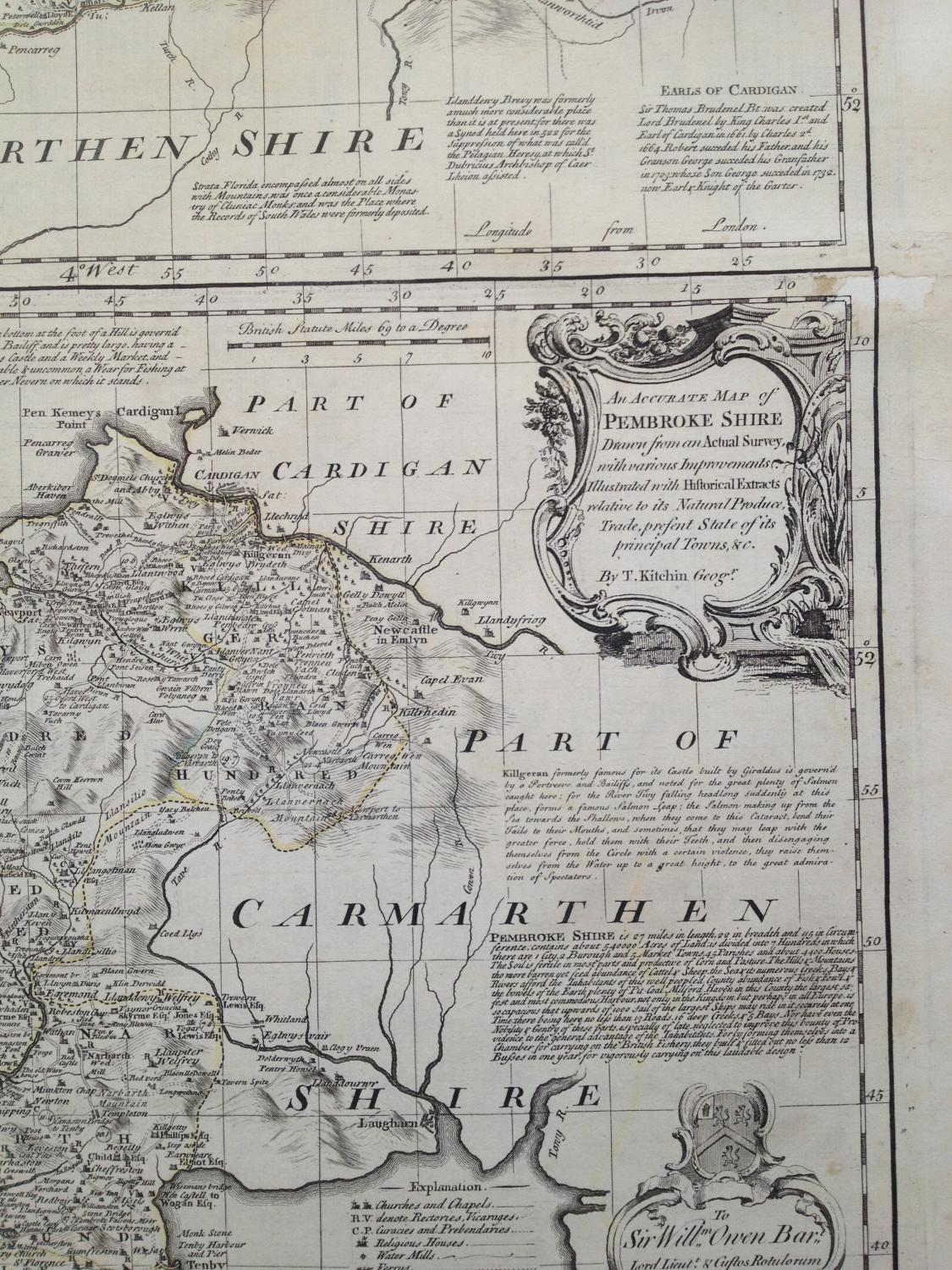
Code: JR2033
Date: c 1760
Condition: B
Colour: Original
Size: 52 x 70 cms
An intricate and elegant map by Thomas Kitchin produced in the 1760's. Richly decorated with very subtle original colouring of major boundaries and a view of Haverfordwest.
From: The Large English Atlas: or, a New Set of Maps of all the Countries in England and Wales], T. Bowles, John Bowles, John Tinney, and Robert Sayer, [c.1760]