Email: james@mapmogul.com
Web site: https://www.mapmogul.com/
|
|
Tel: +44 (0) 7764 165300 - Order by Phone / Online Email: james@mapmogul.com Web site: https://www.mapmogul.com/ |
|
Code: JR1971
Date: c 1760
Condition: AAA
Colour: Original
Size: 52 x 70 cms
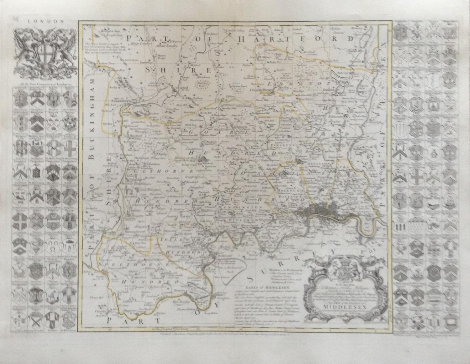
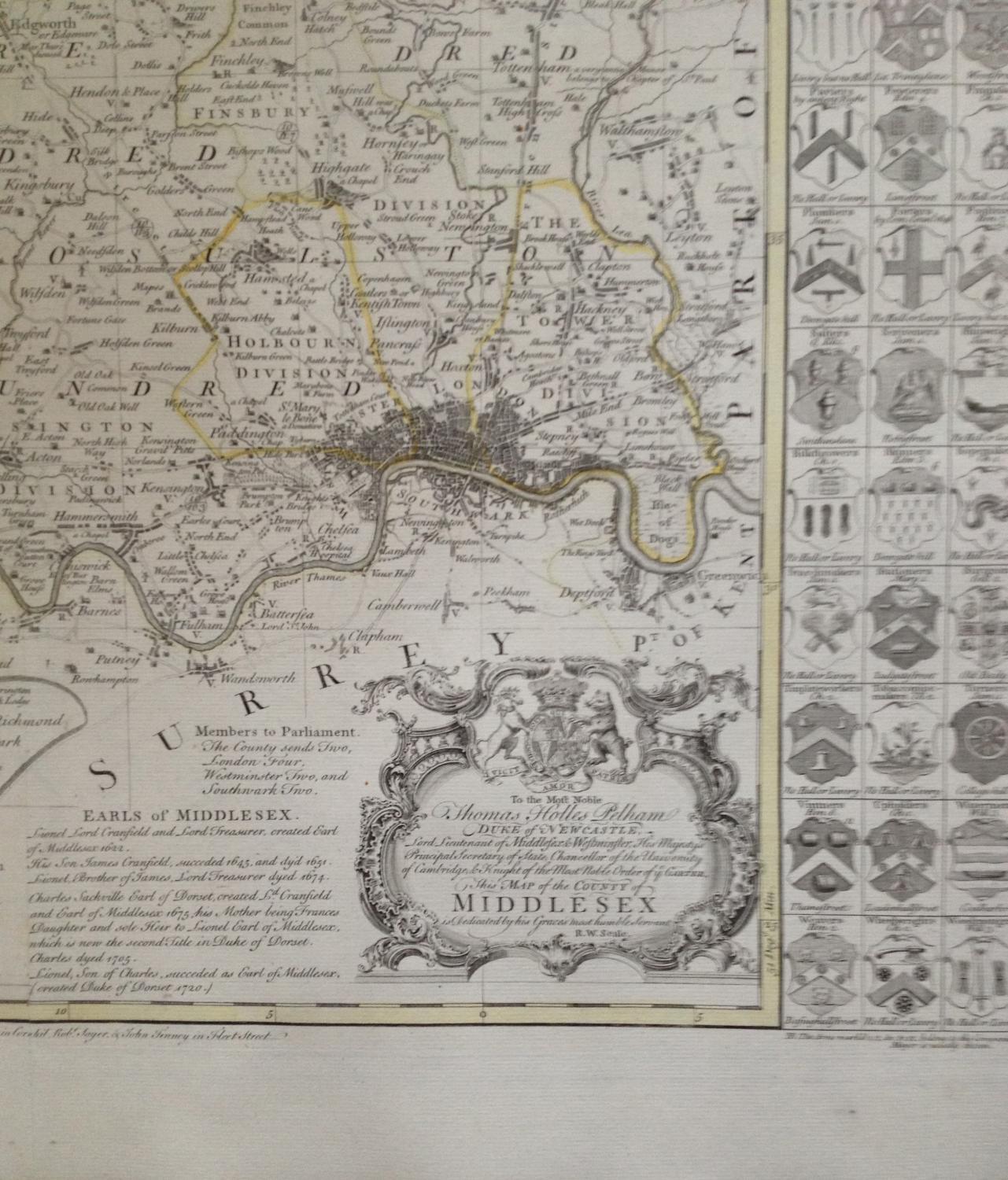
Title: 'To the Most Noble / Thomas Holles Pelham / Duke of NEWCASTLE. / Lord Lieutenant of Middlesex & Westminster, His Majesty's / Principal Secretary of State, Chancellor of the University / of Cambridge, & Knight of the Most Noble Order of y e GARTER. / This MAP of the COUNTY of MIDDLESEX / is Dedicated by his grace's most humble Servant / R.W. Seale.; below image: [centre] Printed for T: Bowles in S.t Pauls Church Yard, John Bowles & Son, in Cornhil, Rob.t Sayer, & John Tinney in Fleet Street'.
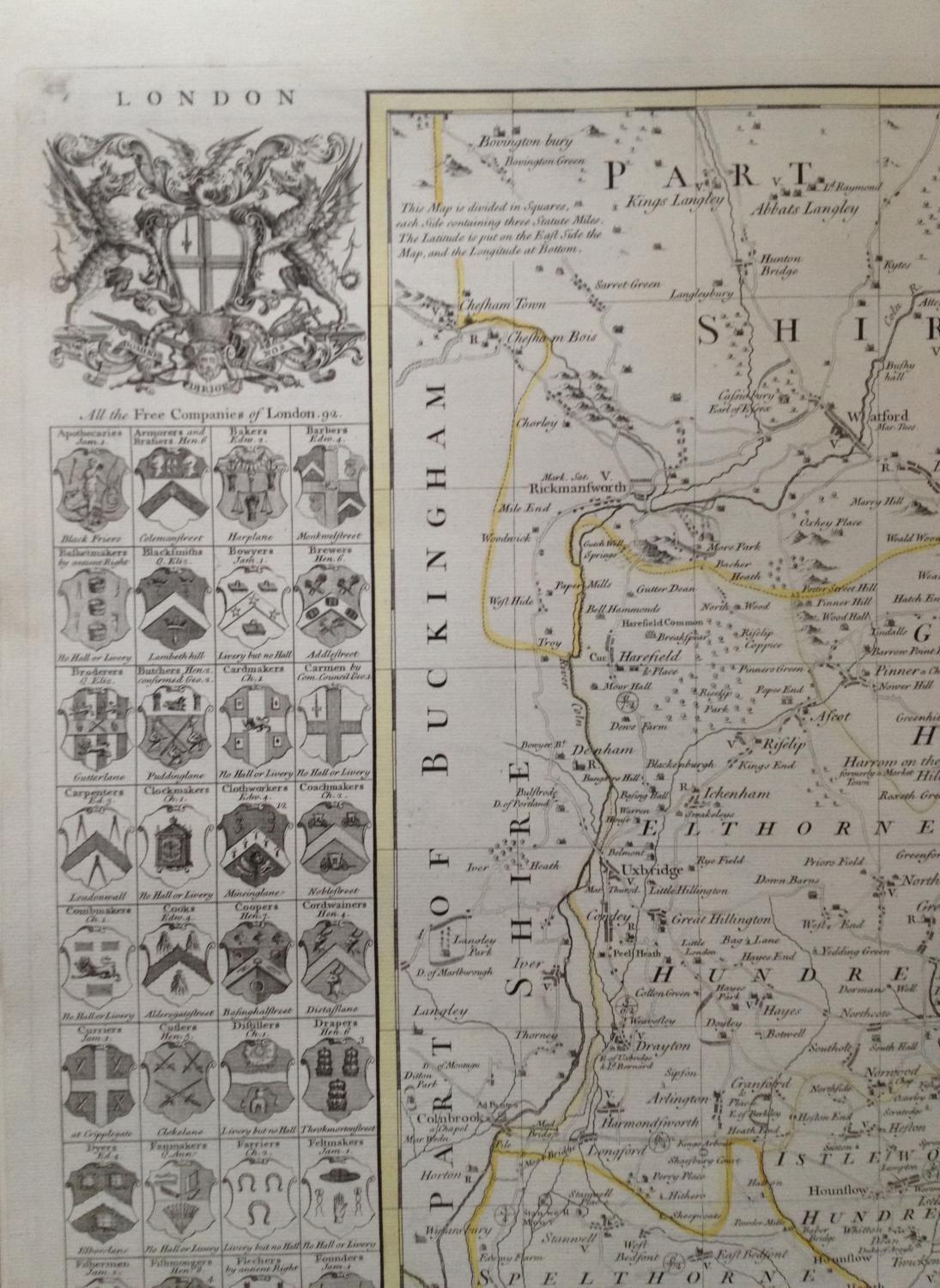
A large and decorative eighteenth century map of the county of Middlesex by the London draughtsman and cartographer; Richard Seale, printed by Bowles, Sayer and Tinney in Fleet Street and included in 'The Large English Atlas' by Bowen and Kitchin. Robert Seale worked on many maps for an assortment of widely published surveys, magazines and atlases.
This map is flanked by the arms of all 92 Livery Companies of the City of London. Although they are listed alphabetically, the reality is that in 1515 the Court of Aldermen of the City of London settled an order of precedence for the forty-eight Livery Companies then in existence, which was based on the Companies’ economic and political power. There are now 108 such companies in existence. The map is enhanced by a decorative rococo style title cartouche and a large City of London coat of arms.
From: The Large English Atlas: or, a New Set of Maps of all the Countries in England and Wales], E. Bowen. T. Bowles, John Bowles, John Tinney, and Robert Sayer, [c.1760]