Tel: +44 (0) 7764 165300 - Order by Phone / Online Email: james@mapmogul.com Web site: https://www.mapmogul.com/
SOLD Regni Poloniae Vicinarumque Regionum..
SOLD
Code: 78183
SOLD
Date: 1696
Condition: AA
Colour: Uncoloured
Size: 37,4 x 29,2 cm
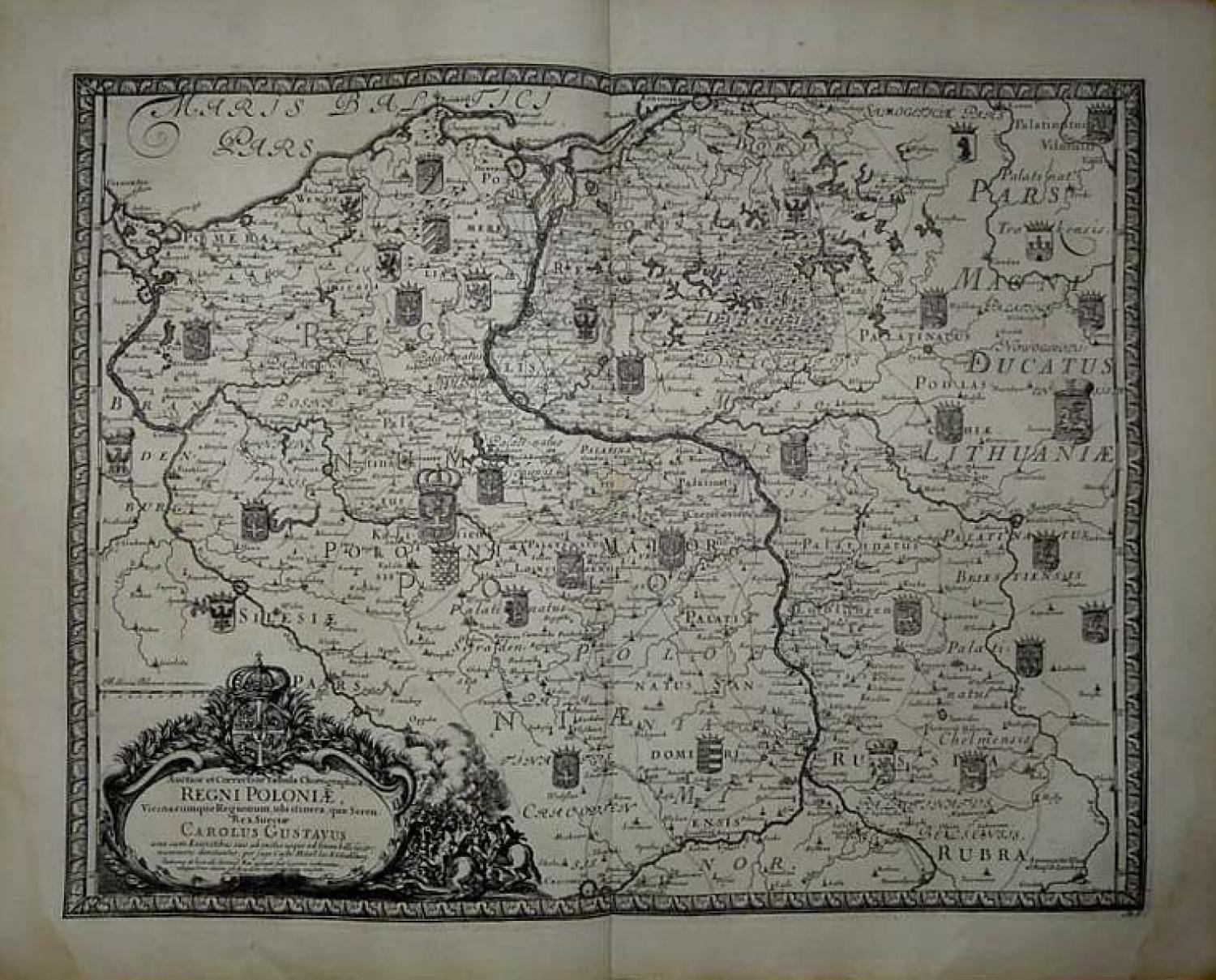
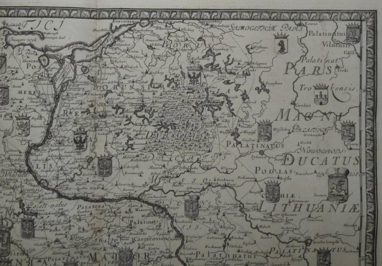
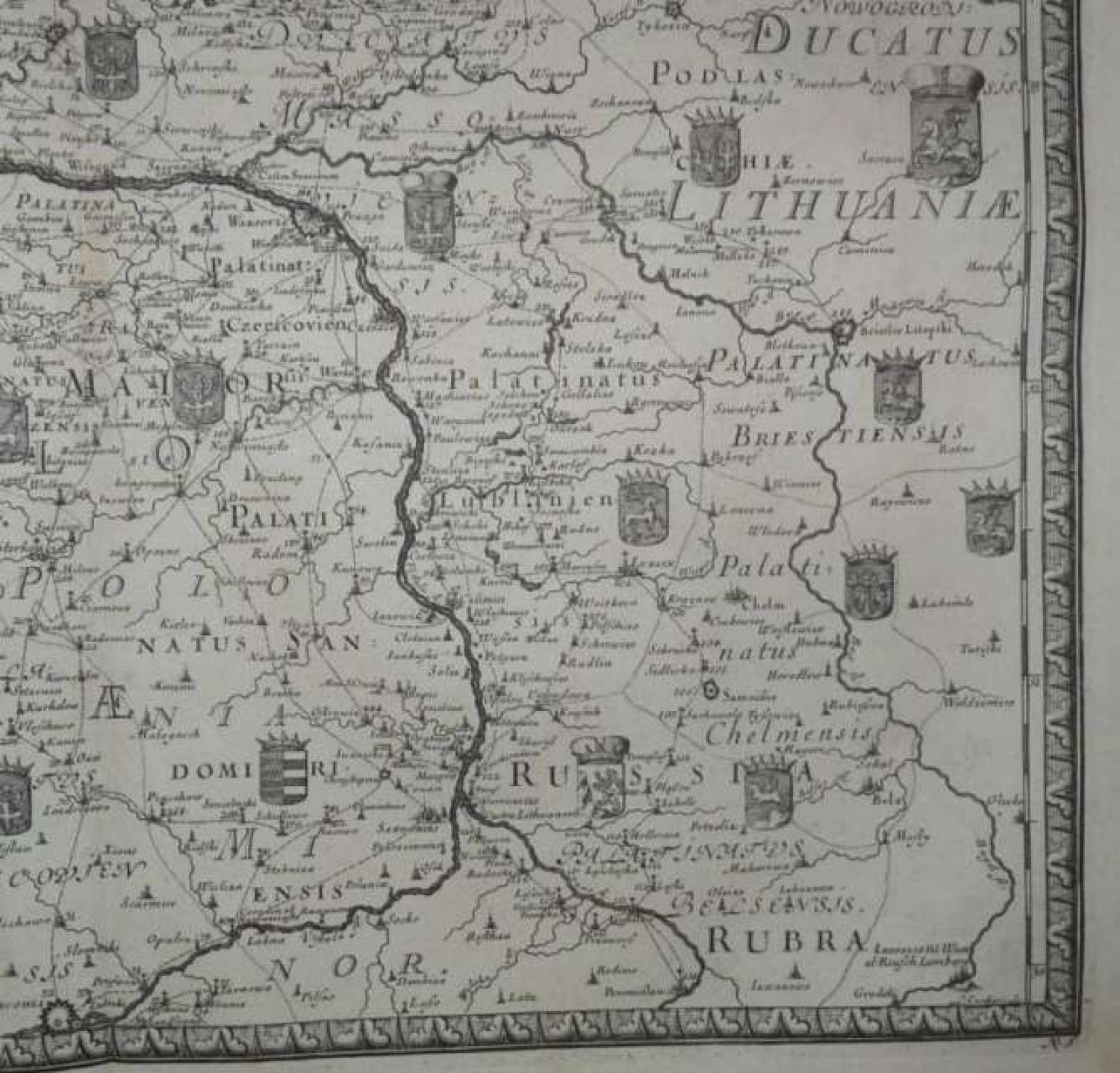
Title: 'Auctior et Correctior Tabula Chorographica Regni Poloniae Vicinarumque Regionum, ubiitinera, quae Seren Rex Sueciae Carolus Gustavus ...' from: Pufendorf, Samuel, Freiherr von.
De rebus a Carolo Gustavo Sveciae rege gestis commentariorum
Norimbergae : Sumptibus Christophori Riegelii, Literis Bielingianis, anno M.DC.XCVI [1696].
Fine and decorative copper engraved showing the region bounded by the Baltic, the Oder, the Bug and the Vistula and extending south to Krackow, east to Brierstie Litepski, north to Konigsberg and west to Stetin, Glogau and Breslau. The two unique features of this map are the dozens of heraldic crests which adorn the map and the many roads shown on the map, which was very uncommon during the 17th Century. Frame-style borders.
Very good condition. Strong and dark impression on strong paper. Paper with chains and wiremark. Wide margins. Very small foxing and browing. Some small waterstains.