Tel: +44 (0) 7764 165300 - Order by Phone / Online Email: james@mapmogul.com Web site: https://www.mapmogul.com/
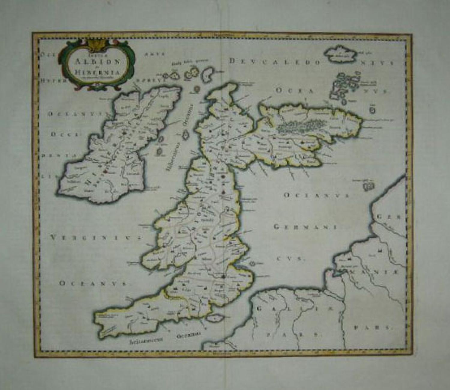
SOLD Insulae Albion et Hibernia cum minoribus adjacentibus
SOLD
Code: 77627
SOLD
Date: c 1640
Condition: AA
Colour: Original
Size: 420 x 530mm
Title: 'Insula Albion et Hibernia'. Dutch text on verso.
A very impressive Ptolemeaic map of the British Isles by Blaeu showing an early view of the cartographer's developing shape of the island.
ALBION (England & Wales) take a sharp right angle turn at BRITANNIA (Southern Scotland), which is depicted as lying East to West. HIBERNIA (Ireland) lies in the Eastern Ocean (Atlantic). Britain is separated from France by the "British Ocean" and from Germany by the "German Ocean". LONDINIUM is the capital.
The map has a dark impression with original colouring with wide margins. A few faint spots and mild toning with some wrinkling, else very good condition.