Tel: +44 (0) 7764 165300 - Order by Phone / Online Email: james@mapmogul.com Web site: https://www.mapmogul.com/
SOLD Iaponiae insulae descriptio
SOLD
Code: 77588
SOLD
Date: 1595
Condition: AAA
Colour: Uncoloured
Size: 32 x 45 cm
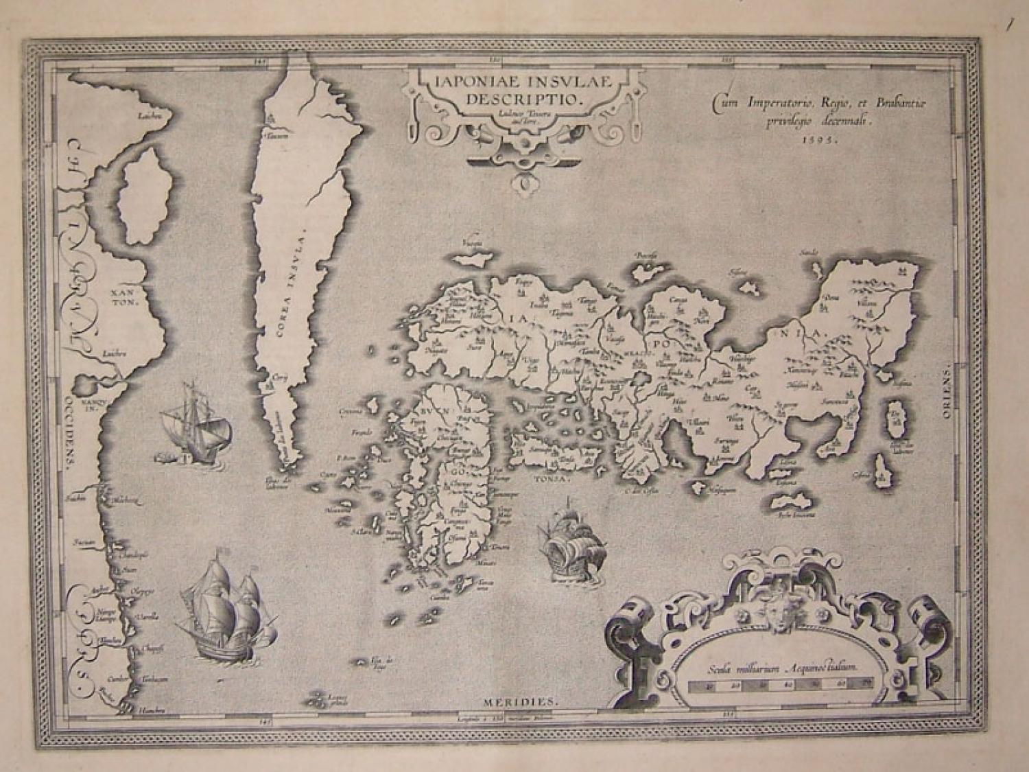
Title: 'Iaponiae insulae descriptio / Ludoico Teisera auctore..' from Ortelius' important World Atlas "Theatrum Orbis Terrarum".
A famous map of Japan based on Ludovico Teixeira, a Portuguese Jesuit cartographer and mathematician. The first map of Japan published in a European atlas.
Teixeira utilized information generated from Japanese sources to present the first reasonably accurate and recognizable depiction of Japan, including numerous Japanese place names. The island of Ezo (called Hokkaido now) has been omitted, Korea appears as an island, with its curious northern point named Punta dos ladrones.
The map is richly embellished with three large galleons, two elaborate cartouches and a boldly engraved border. This influential map was to become the basis for many other cartographer's maps of Japan for more than fifty years.