Tel: +44 (0) 7764 165300 - Order by Phone / Online Email: james@mapmogul.com Web site: https://www.mapmogul.com/
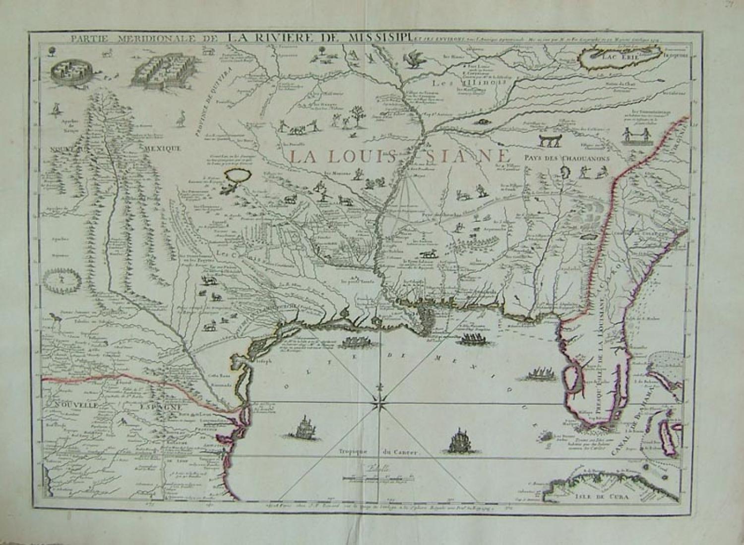
SOLD Partie Meridionale de la Riviere de Missisipi...
SOLD
Code: 77547
SOLD
Date: 1718
Condition: AAA
Colour: Original
Size: 18 x 26 inches
Partie Meridionale de la Riviere de Missisipi, et ses Environs, dans l'Amerique Septentrionale ... Published in Paris by Jacque Francois Benard (son-in-law of De Fer).
An elegant map based on De L'Isle's manuscript map of 1701. First published by De Fer in 1715. The map covers a vast geographical area extending from Lake Erie to New Mexico. One of its notable features is the delineation of the Carolina trading path from Charles town to la Mobile R and west to the intersection of the Arkansas River with the Mississippi River. In addition, it includes considerable details about Indian settlements along the Red River and Upper Rio Grande.
In excellent condition with a mild crease parallel to the lower centerfold.