Tel: +44 (0) 7764 165300 - Order by Phone / Online Email: james@mapmogul.com Web site: https://www.mapmogul.com/
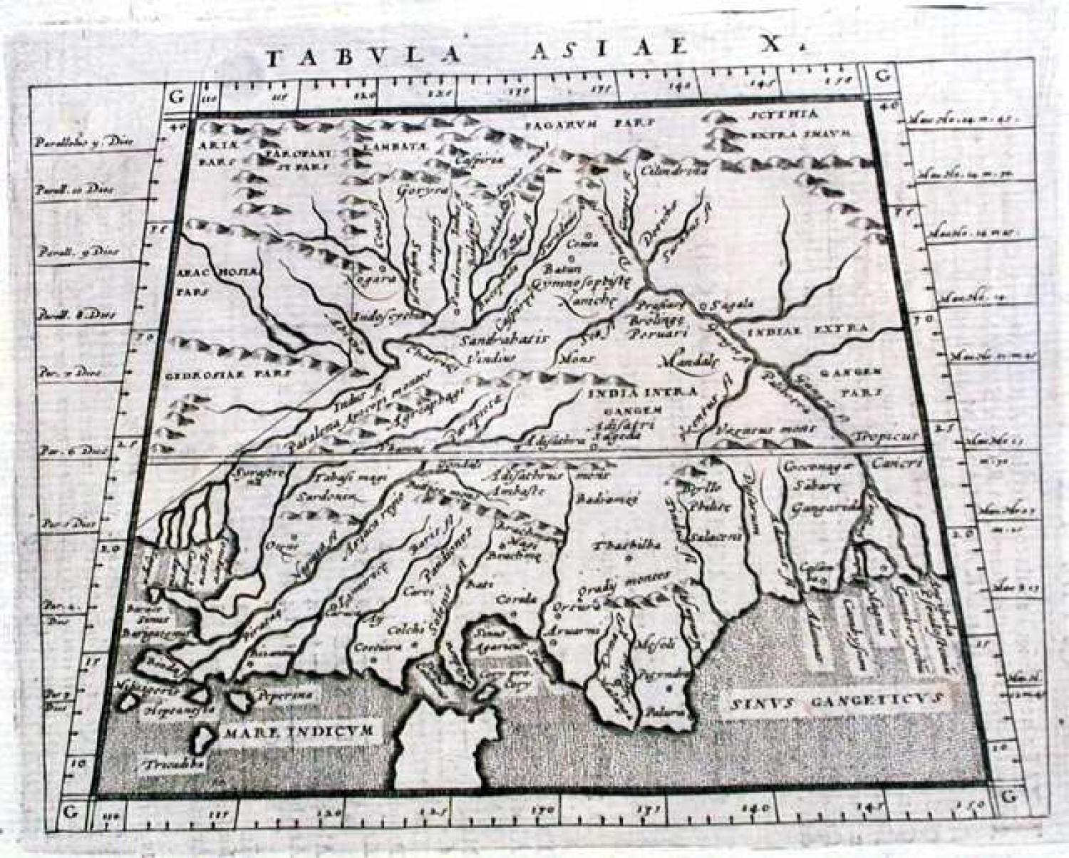
SOLD Title: Tabula Asiae X
SOLD
Code: 77222
SOLD
Date: 1597
Condition: AAA
Colour: BW
Size (cm): 12.5 x 17.2 (excluding title)
Title: Tabula Asiae X. Publication: Geographiae universae tum veteris, tum novae absolutissimum opus... Auctore eodem Io. Anto. Magino Patavino..., Cologne 1597, Petrus Keschedt.
Engraver: Magini. G / Anon
A Ptolemaic map of India and of Sri Lanka (Ceylon). The sub-continent is considerably foreshortened with the rivers Indus and Ganges as the only recognisable features. The Based on the 1561 Valgrisi edition. Text on verso.
The map comes from a scarce pirate edition published by Petrus Keschedt in Cologne one year after the publication of Magini's original work. Ortelius informed Magini in November 1597 about this and the publication was stopped till 1608 when a new edition was issued by Keschedt. Although the map is based on Magini's 1596 Geographiae it is in fact a new plate. The Magini's 1596 edition of Geographiae was the first reduced size version of Mercator's atlas. This is the second.
Claudius Ptolemaeus, better known as Ptolemy (born after 80 and died before 180 CE) made many important contributions to geography and spatial thought. He wrote on many topics, including geography, astrology, musical theory, optics, physics, and astronomy. Ptolemy collected, analyzed, and presented geographical knowledge so that it could be preserved and perfected by future generations. These ideas include expressing locations by longitude and latitude, representing a spherical earth on a flat surface, and developing the first equal area map projection. Although his Geography hasn't survived to this day it is thought that in the 13th century a Bizantine monk discovered his manuscripts and had them reproduced, including 27 maps of the then known world.