Tel: +44 (0) 7764 165300 - Order by Phone / Online Email: james@mapmogul.com Web site: https://www.mapmogul.com/
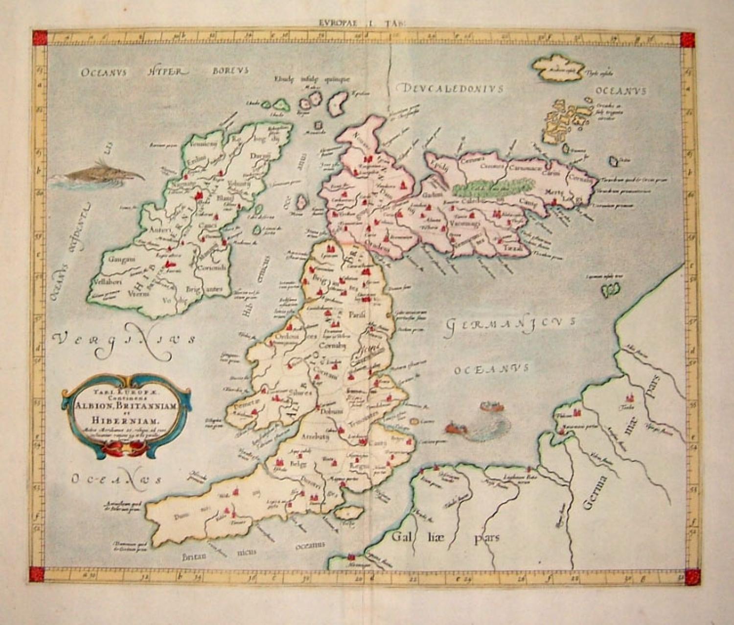
SOLD TAB I EUROPAE, Continens ALBION, BRITANNIAM et HIBERNIAM
SOLD
Code: 77013
SOLD
Date: (1578) 1698
Condition: AA
Colour: Hand colour.
Size: 16 x 13.25 inches (42 x 34 cm)
From CLAUDII PTOLEMAEI's atlas Tabulae geographicae ORBIS TERRARUM Veteribus cogniti. (Colophon:) TRAJECTI ad RHENUM Apud FRANCISCUM HALMAM, GUILJELMUM vande WATER , Bibliop. MDCXCVIII
Published in Utrecht by FRANCISCUS HALMA and GUILJELMUS van der WATER and in Franeker by LEONARDUS STRICK in 1698.
This rare map of the British Isles shows an early view of the cartographer's developing shape of the island. ALBION (England & Wales) take a sharp right angle turn at BRITANNIA (Southern Scotland), which is depicted as lying East to West. HIBERNIA (Ireland) lies in the Eastern Ocean (Atlantic). Britain is separated from France by the "British Ocean" and from Germany by the "German Ocean". LONDINIUM is the capital.
Originally published by MERCATOR in his 1578 edition, this map is from an 1698 edition and features changes from the original atlas as cartouches and some place names have been reengraved. The ornamental border of the map first appeared in this edition. This edition of Ptolemy's maps feature beautiful cartouches, fabulous depictions of ficticious sea monsters and sailing ships.
The map is in excellent condition with little browning and one or two small stains in the outer margin. There is a crease in upper left margin and a corner fold in bottom right margin. All of these small flaws are outside of the image plate. A very fine example. Blank on verso and folded as issued.