Tel: +44 (0) 7764 165300 - Order by Phone / Online Email: james@mapmogul.com Web site: https://www.mapmogul.com/
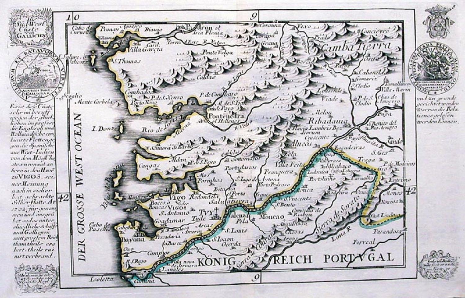
SOLD Die Sud-West Custe von Gallicien
SOLD
Code: 76905
SOLD
Date: c. 1704
Condition: AAA
Colour: Outline colour
Size (cm): 17.4 x 28.0 (inclusive of description)
Publication: Atlas Curieux oder neuer und compendieuser Atlas ..., Augsburg.
This engraving shows the Spanish coast of Galicia stretching from the Portuguese port of Caminha in the south, to the Spanish town of Padron in the north. Numerous mountain ranges, towns and villages are shown. Text to the left and right of the map relates the sea battle between the combined English and Dutch fleets and the Spanish West Indies fleet. This encounter took place in 1702 outside of the port of Vigo. A miniature circular engraving inserted in the left column depicts the battle. Scarce. Fold(s) as given.