Tel: +44 (0) 7764 165300 - Order by Phone / Online Email: james@mapmogul.com Web site: https://www.mapmogul.com/
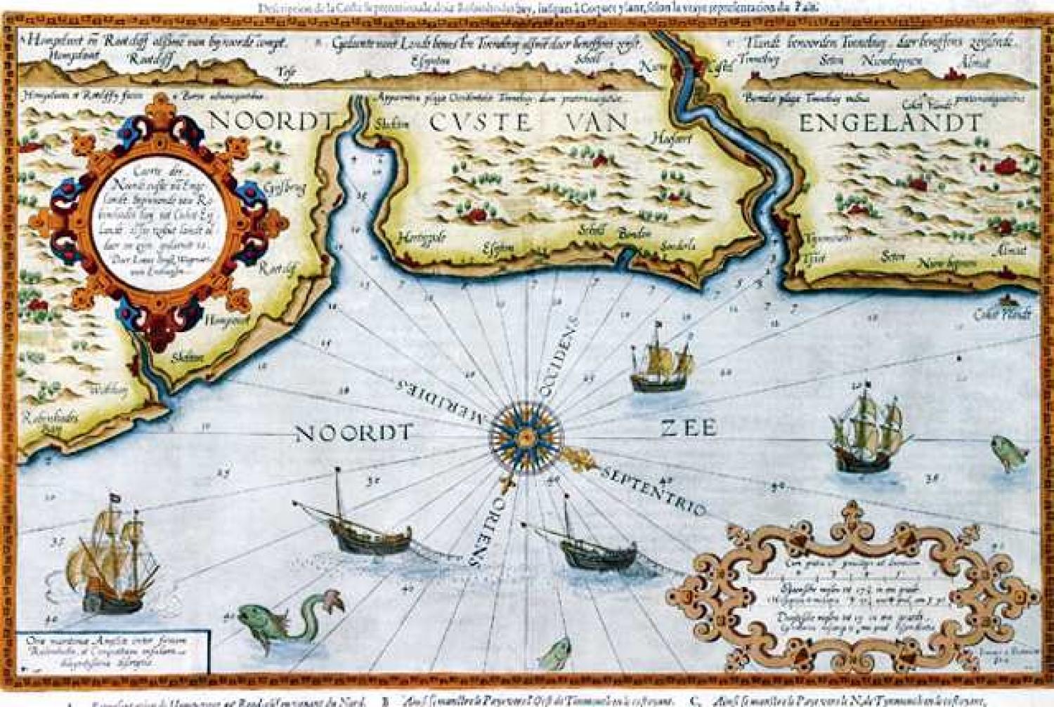
SOLD Caerte der Noordt custe va Engelandt
SOLD
Code: 76703
SOLD
Date: 1590.
Condition: AAA.
Colour: Old.
Size: 33 x 51 cms.
Title: 'Caerte der Noordt custe va Engelandt'.
This rare chart shows approximately a 100 mile stretch of the East coast of England between the latitudes 55 23' and 54 26', from Alnmouth in the North to Robin Hood's Bay in the South. Verso: On the left sheet a short history of England fro William the Conqueror to Elisabeth 1. On the right sheet specific information for the navigator. Decoration: 2 decorative cartouches, ornate compass rose, 1 man-o-war, 2 merchant ships, 2 fishing trawlers, 3 sea monster. General: Because these antique charts were actively used few have survived. Examples in good condition are rare. Condition: Slight offsetting of the border where the chart had been folded. small tear to the upper centrefold well away from the plate mark. Wide margins