Tel +44 (0) 7764 165300 - Order by Phone / Online
You have ( 0 ) item(s) in your basketTel +44 (0) 7764 165300 - Order by Phone / Online
You have ( 0 ) item(s) in your basket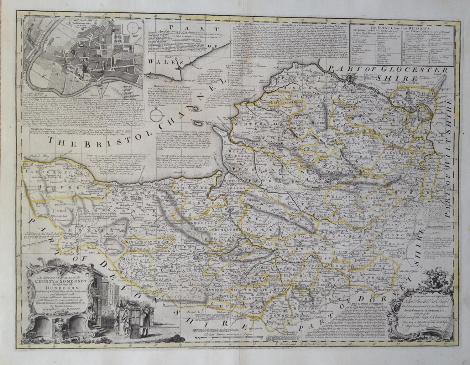
Code: JR1981
Date: c 1760
Condition: AAA
Colour: Original
Size: 52 x 70 cms
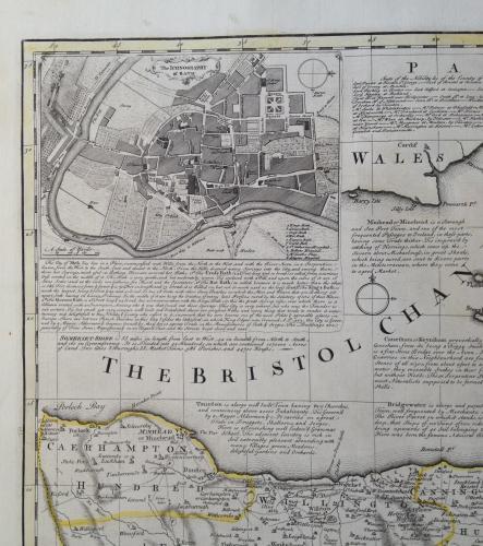
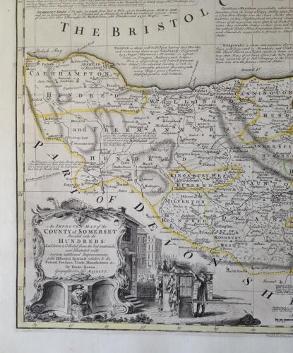
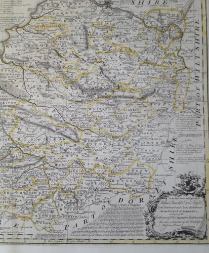
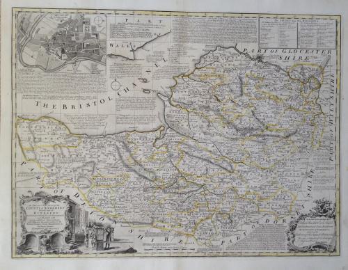
An intricate and elegant map of Somerset by Emmanuel Bowen produced in the 1760's. Richly decorated with an insert city plan of Bath and very subtle original colouring of major boundaries.
From: The Large English Atlas: or, a New Set of Maps of all the Countries in England and Wales], T. Bowles, John Bowles, John Tinney, and Robert Sayer, [c.1760]