Tel +44 (0) 7764 165300 - Order by Phone / Online
You have ( 0 ) item(s) in your basketTel +44 (0) 7764 165300 - Order by Phone / Online
You have ( 0 ) item(s) in your basket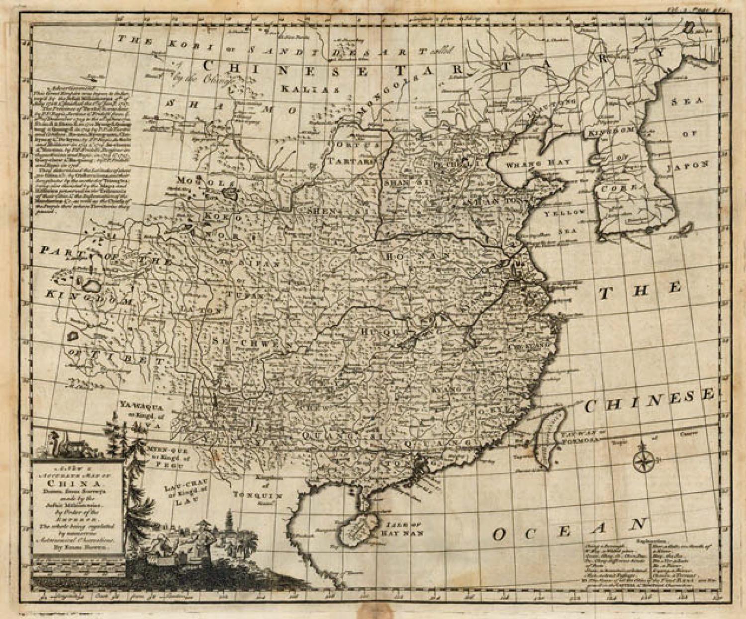
Code: JR2075
Date: c 1748
Condition: AA
Colour: Uncoloured
Size: 42 x 36 cms
Title: '"A New & Accurate Map of China. Drawn from Surveys Made by the Jesuit Missionaries by Order of the Emperor..." Publication: John Harris' Navigantium Atque Itinerantium Bibliotheca
A finely engraved map of China and Korea with detail primarily in China. The map was derived from the Jesuit survey of 1708 to 1717. A table at left details these surveys and a key at bottom right provides the meaning of relevant Chinese words. Embellished with pictorial title cartouche and small compass rose.
Condition Description: A dark impression with light toning and offsetting. There are a few spots of foxing confined to the blank margins.
Ref: Shirley (BL Atlases) G.HARR-1a #28.
