Tel +44 (0) 7764 165300 - Order by Phone / Online
You have ( 0 ) item(s) in your basketTel +44 (0) 7764 165300 - Order by Phone / Online
You have ( 0 ) item(s) in your basket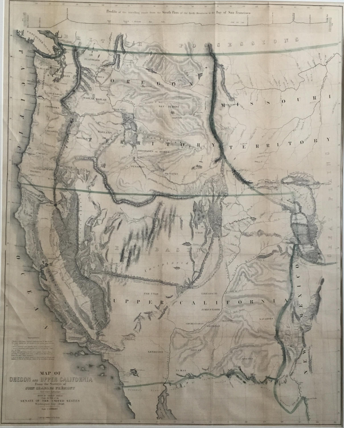
Code: JR2094
Date: 1848
Condition: AA
Colour: Original
Size: 85 x 68 cms
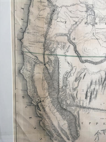
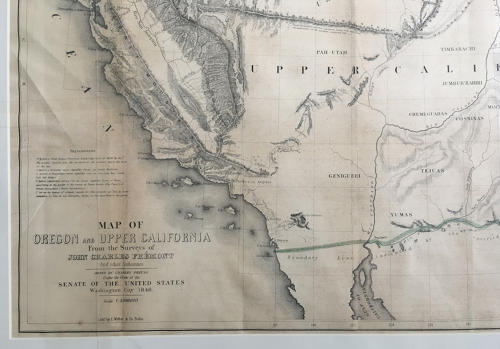
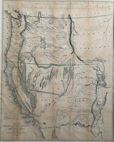
Title: 'Map Of Oregon And Upper California From the Surveys of John Charles Fremont And other Authorities. Drawn By Charles Preuss Under the Order of the Senate Of The United States, Washington City 1848. Lithy. by E. Weber & Co. Balto. (inset) Profile of the travelling route from the South Pass of the Rocky Mountains to the Bay of San Francisco.'
The map for the first time filled in the details of the Great Basin. Charles Preuss drew the map. A smaller version of the map appears in President Polk's Message of 1849.
In very good condition, minor toning. Mounted.