Tel +44 (0) 7764 165300 - Order by Phone / Online
You have ( 0 ) item(s) in your basketTel +44 (0) 7764 165300 - Order by Phone / Online
You have ( 0 ) item(s) in your basket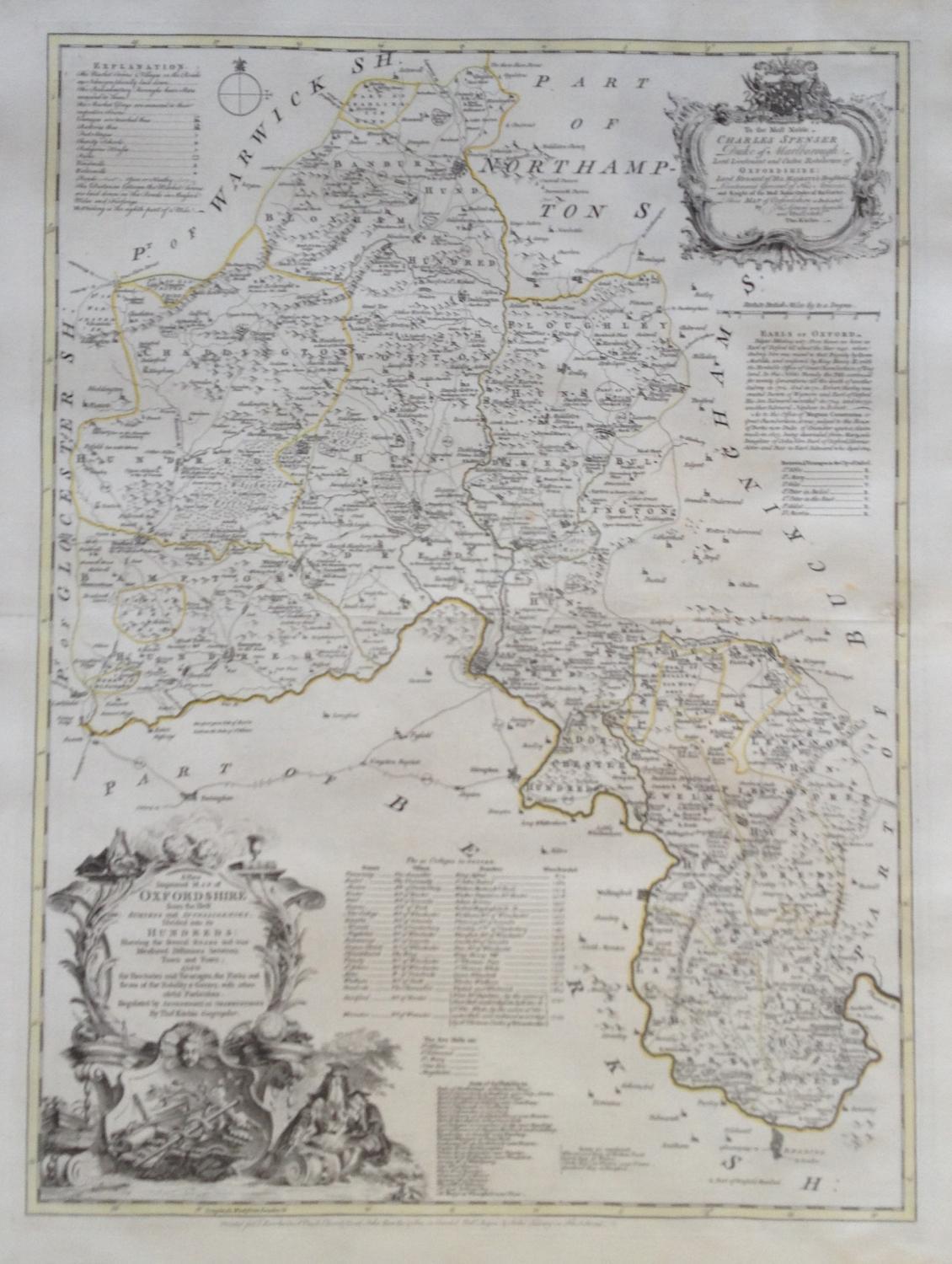
Code: JR1973
Date: c 1760
Condition: AA
Colour: Original
Size: 52 x 70 cms
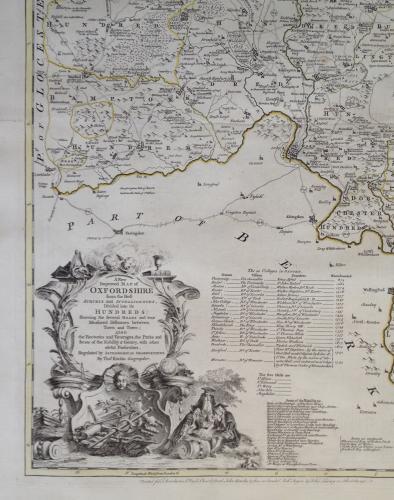
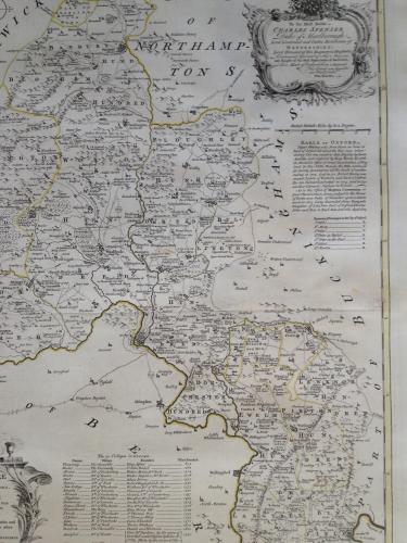
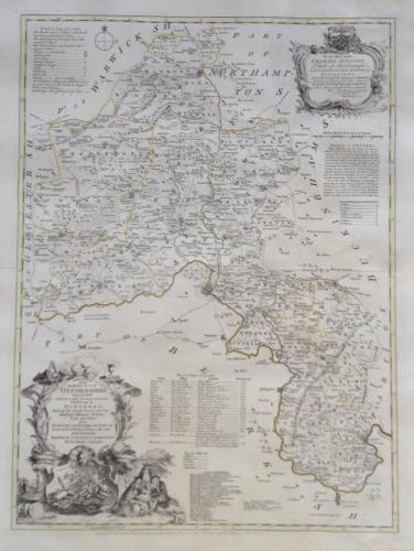
An intricate and elegant map by Thomas Kitchin produced in the 1760's. Richly decorated with very subtle original colouring of major boundaries.
From: The Large English Atlas: or, a New Set of Maps of all the Countries in England and Wales], T. Bowles, John Bowles, John Tinney, and Robert Sayer, [c.1760]