Tel +44 (0) 7764 165300 - Order by Phone / Online
You have ( 0 ) item(s) in your basketTel +44 (0) 7764 165300 - Order by Phone / Online
You have ( 0 ) item(s) in your basket
Code: JR2127
Date: c 1736
Condition: B
Colour: Original
Size: Quarto
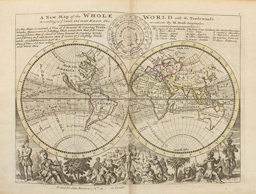
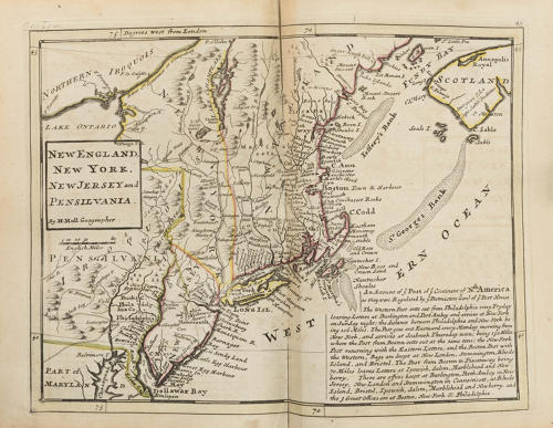
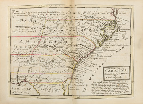
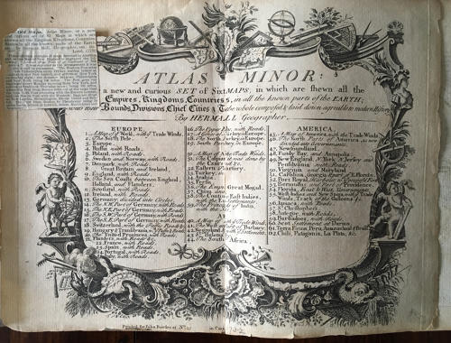
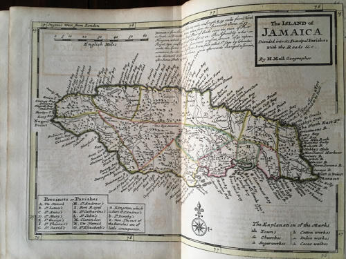
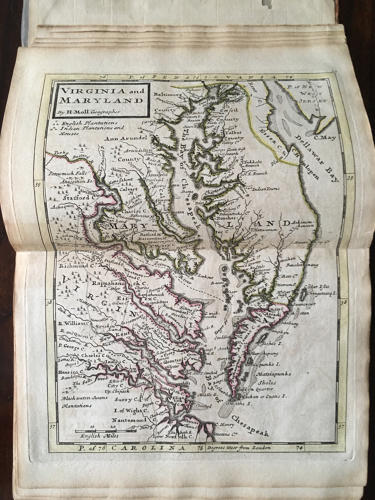
Title: 'Atlas minor: or a new and curious set of sixty-two maps, in which are shewn all the empires, kingdoms, countries, states, in all the known parts of the earth; with their bounds, divisions, chief cities & towns, the whole composed & laid down agreable to modern history. By Herman Moll, Geographer'. Published in London by John Bowles, circa 1732. This is the third edition of 1736.
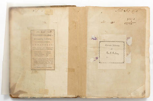
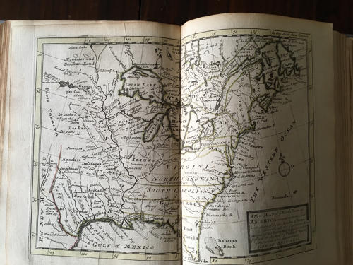
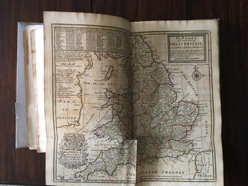
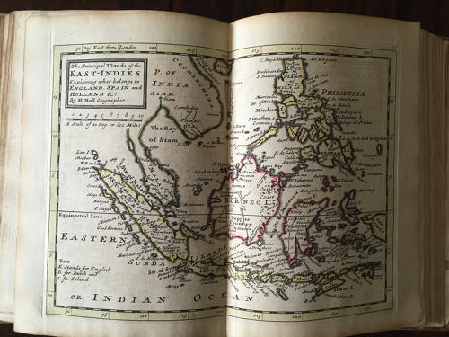
With all sixty-two colored and tipped-in maps, some fold-out. Oblong O. Half calf with paper boards. Ex-library of 'Stephen Clark's Circulating Library, Annapolis and George E. Fosberg'.
Reference Note on this edition (David Rumsey Map Collection):
Contains 62 hand col. double-page engraved maps (10 folding)....Like most of Moll's works, the majority of the maps are undated, although the maps of Great Tartary (no. 32) and "The West Part of Barbary" (no. 41) are dated 1732. The deciding factor which makes this copy the 3rd. ed. is map no. 13 (Germany) which carries the added legend, "Lorrain was ceded to France A.D. 1736 ..." Includes 29 maps of Europe, 10 of Asia, 5 of Africa and 18 of the Americas, including the double-hemisphere world map (no. 1) and the map of America (no. 45) that show California as an island.
Condition: Binding with extensive and significant wear and loss. Hinges cracked. Front loose flyleaf and title page with repairs. Maps with scattered tears and repaired tears, particularly along folds. Toning. Map of Nova Scotia with water stains.