- SOLD
- Date: 1648.
- Condition: AAA
- Colour: Original.
- Size: 42 x 50 cm
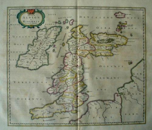
Title: 'Insula Albion et Hibernia'.
A very impressive Ptolemeaic map of the British Isles by Blaeu showing an early view of the cartographer's developing shape of the island.
ALBION (England & Wales) take a sharp right angle turn at BRITANNIA (Southern Scotland), which is depicted as lying East to West. HIBERNIA (Ireland) lies in the Eastern Ocean (Atlantic). Britain is separated from France by the "British Ocean" and from Germany by the "German Ocean". LONDINIUM is the capital.
The map is in excellent condition with very slight foxing at the margin (well away from the plate area).