- SOLD
- Date: c. 1595
- Condition: B
- Colour: Uncoloured
- Size: 12 7/8 x 16 inches.
- 'Crease marks' are due to the scanning process and are not on the map.
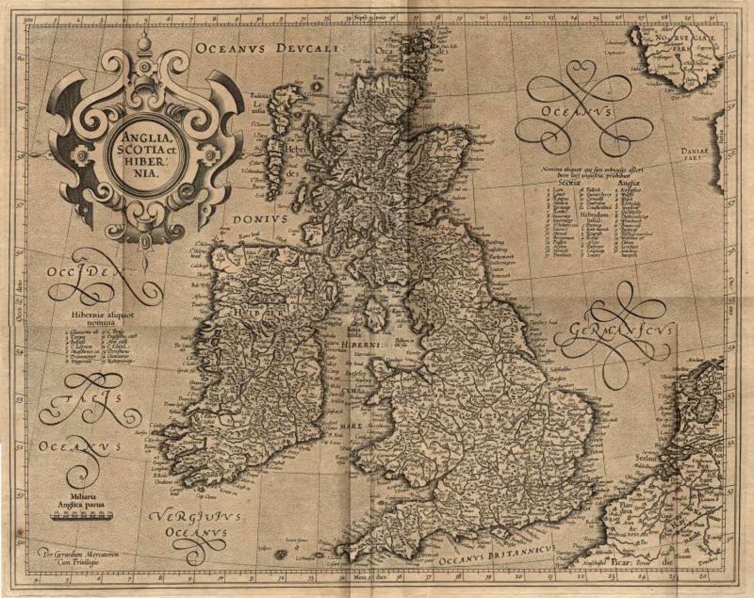
From Mercator's Atlas part III. First published in 1595. French Text on verso.
Gerard Mercator is probably only second to Ptolemy in his influence on the development of cartography. This map has a strong impression with a highly decorative strapwork title cartouche and a large amount of detail of Elizabethan Britain.
There is a crease across the image area that should not be noticeable when the map is framed. Some small centerfold splits. Overall in fair condition but the image area is good.
KOEMAN: ME 23A; SHIRLEY: British Isles 180 & 335.