Tel +44 (0) 7764 165300 - Order by Phone / Online
You have ( 0 ) item(s) in your basketTel +44 (0) 7764 165300 - Order by Phone / Online
You have ( 0 ) item(s) in your basket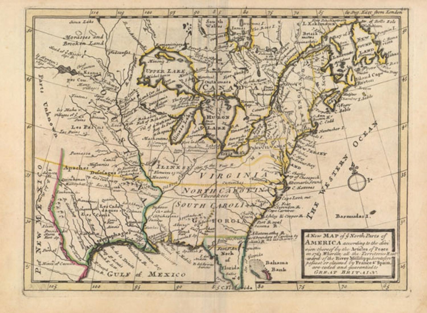
Code: JR1908
Date: 1763
Condition: AA
Colour: Original
Size: 10.8 x 7.8 inches
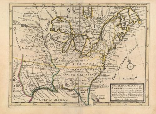
Title: 'A New Map of Ye North Parts of America According to the Division Thereof by the Articles of Peace...' rare Bowles edition.
This small map depicts the eastern United States and Canada shortly after the French & Indian War. The war ended French colonial ambitions in North America and was one of the most significant developments in a century of Anglo-French conflict. The British colonies extend to the Mississippi River including the large Virginia, North Carolina, South Carolina and Georgia. The map is filled with interesting notations in the central region including "Parts Unknown" in the Great Plains and "Morasses and Brooken Land" in Canada, as well as numerous Indian place names and forts.
Condition Description: Original outline color on watermarked paper with minor marginal soiling.