Tel +44 (0) 7764 165300 - Order by Phone / Online
You have ( 0 ) item(s) in your basketTel +44 (0) 7764 165300 - Order by Phone / Online
You have ( 0 ) item(s) in your basket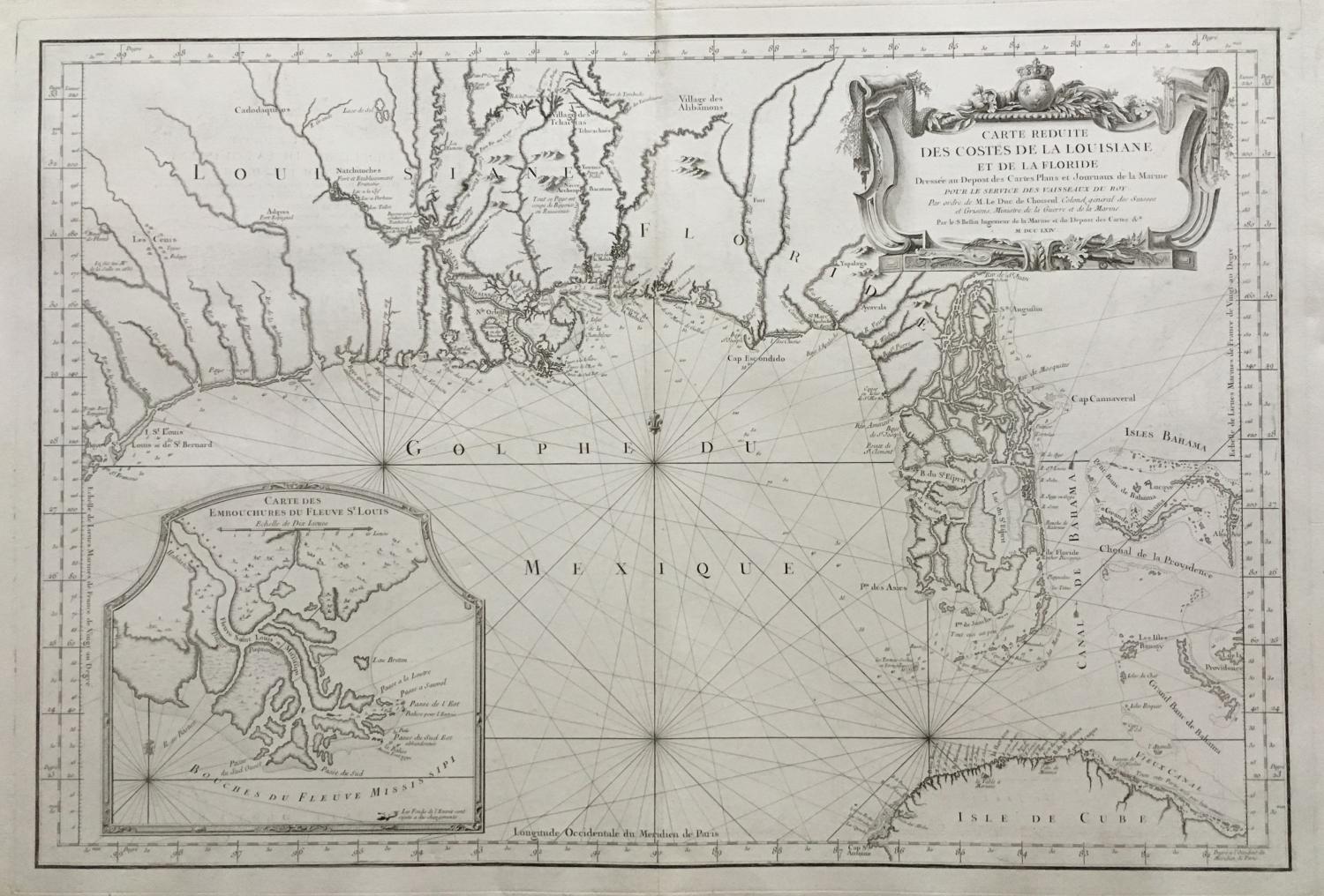
Code: JR1988
Date: 1764
Condition: AAA
Colour: Uncoloured
Size: 38 x 25.2 inches
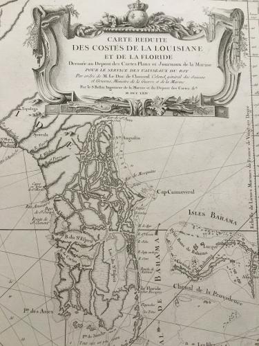
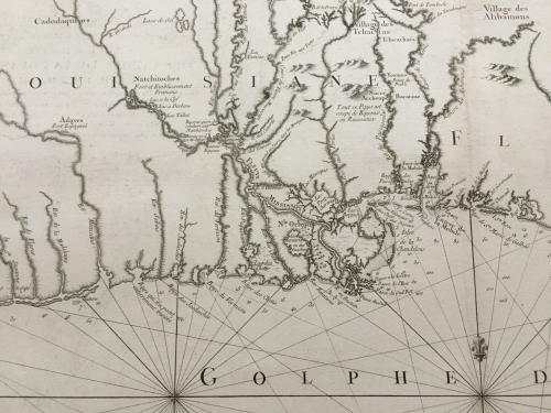
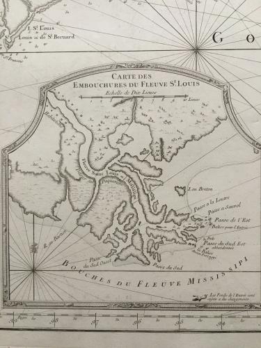
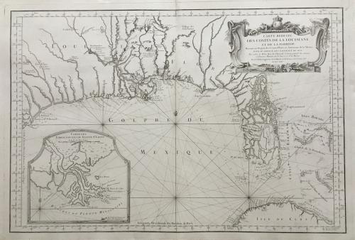
Title: 'Carte Reduite des Costes de la Louisiane et de la Floride"
A very rare and large original engraved sea chart by Bellin from 1764. Details include Florida, the Gulf Coast and the Mississippi Valley. This is one of the best examples of Florida as an Archipelago. The region around the Mississippi Valley and Galveston Bay are also highly detailed for the period. A large and important map from the Depot Générale de la marine with its seal and Prix. Trente Sols.
Ref: Phillips, Atlases 590
In excellent condition, printed on heavy laid paper.