Tel +44 (0) 7764 165300 - Order by Phone / Online
You have ( 0 ) item(s) in your basketTel +44 (0) 7764 165300 - Order by Phone / Online
You have ( 0 ) item(s) in your basket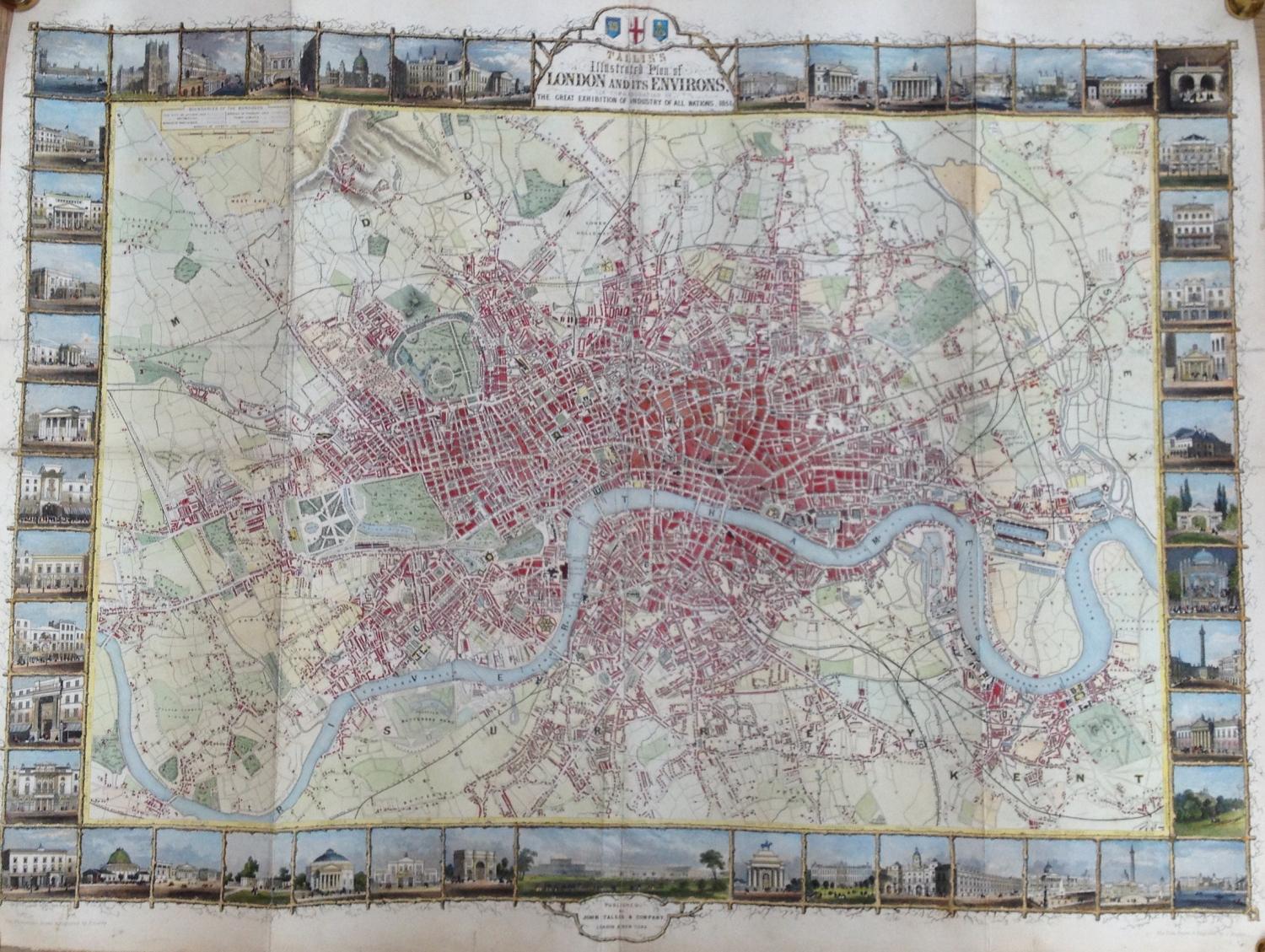
Code: JR1891
Date: 1851
Condition: A
Colour: Hand Colour
Size: 28 x 21 inches
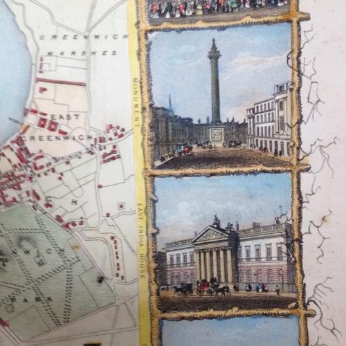
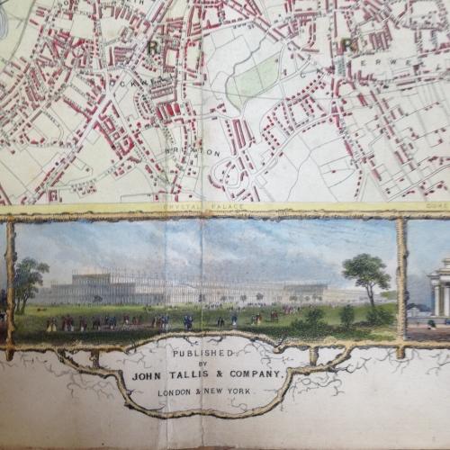
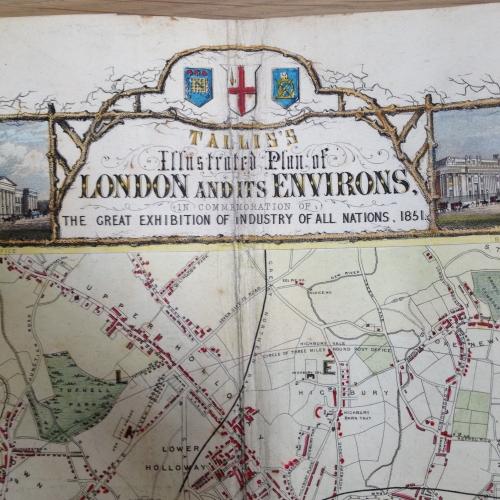
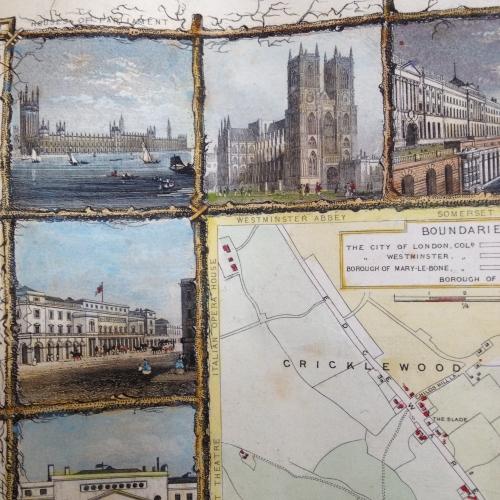
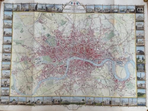
Title: Tallis's Illustrated Plan of London and its Environs..
An impressive large format work, perhaps the most decorative of all of Tallis' City Plans. Engraved for R. Montgomery Martin's Illustrated Atlas.
Tallis was one of the last great decorative map makers. His maps are prized for the wonderful vignettes of indigenous scenes, here the buildings of London.
The town plans engraved by Tallis appear in only a small percentage of his works, making them harder to obtain than his regional maps and the larger format town plans are rarer still.
In good condition with reinforcing tape on the folds of the verso, minor toning and a few marks. Rare.
allis's Illustrated Plan of London and its Environs . . .Tallis's Illustrated Plan of London and its Environs . . .