Tel +44 (0) 7764 165300 - Order by Phone / Online
You have ( 0 ) item(s) in your basketTel +44 (0) 7764 165300 - Order by Phone / Online
You have ( 0 ) item(s) in your basket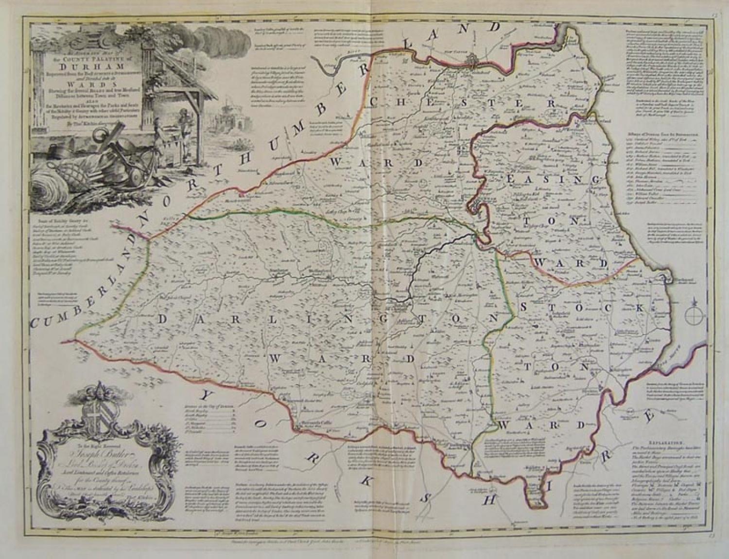
Code: 77642
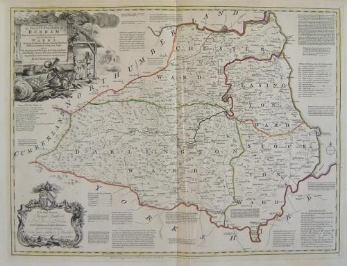
Title: "An Accurate Map of the County Palatine of Durham Improved from the Best Surveys & Intelligences and Divided into its Wards, Shewing the Several Roads and true Measured Distances between Town and Town, Also, the Rectories and Vicarages the Parks and Seats of the Nobility & Gentry with other useful Particulars Regulated by Astronomical Observations."
This was printed in London for 'Carington Bowles, John Bowles & Rob Sayer' circa 1763.
A large and very elegant map with a wealth of information.
The condition is excellent. A previous owner has written 'Durham' on the reverse of the map, in a very neat hand. This is not visible from the front. The edges are generally a little browned with age.
Surrounding the map is a Dedication Cartouche, an Explanation, Seats of Nobility & Gentry, Bishops of Durham since the Reformation and several short pieces of text about the main towns and cities of County Durham.