Tel +44 (0) 7764 165300 - Order by Phone / Online
You have ( 0 ) item(s) in your basketTel +44 (0) 7764 165300 - Order by Phone / Online
You have ( 0 ) item(s) in your basket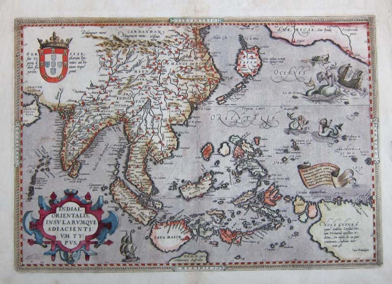
Code: 78461
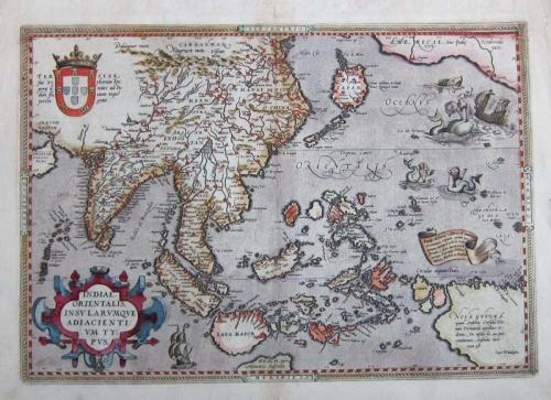
Title: 'Indiae Orientalis, Insularumque Adiacientium Typus'.
From the 1612 edition of Ortelius' Theatrum Orbis Terrarum, the first modern Atlas. French text on verso.
A fine map showing India, China and New Guinea with many points of interest: the map includes Beach and other information drawn from Marco Polo. The map also includes a portion of the West Coast of North America, including several mythical names in California.
This map is based upon Mercator's world map of 1569. The difficulty of mapping this archipelago was such, that for centuries to come maps of the area remain faulty. Sumatra and Java are oversized, and the Philippines are incomplete (without the Northern island of Luzon). The mermaids are based on those occurring on Diego Gutierrez map of America.
The condition is very good with a dark impression and good margins. The original colour is striking and the map is full of character
Ref: VAN DEN BROECKE: 166